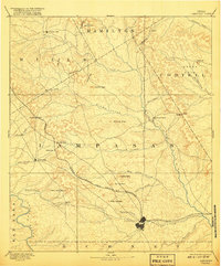
1894 Map of Lampasas
USGS Topo · Published 1917About this map
Lampasas serves as the primary hub of this central Texas landscape, where the Gulf Colorado and Santa Fe Railroad cuts a diagonal path toward the Lampasas River. Surveyed in the mid-1880s, the map reveals a rugged topography defined by numerous gaps and peaks, reflecting the challenging terrain encountered by early settlers and surveyors. Small communities such as Senterfitt, Montvale, and the aptly named Wayback are situated among a complex network of seasonal creeks like School Creek and Big Lucy Creek.
Find a feature on this map
51 named features on this map. Tap any name to fly to it.
Don’t see what you’re looking for? This feature index may not catch every label — zoom into the map to look around manually.
Map Details
Editions of this 1894 Lampasas Map
4 editions found

Other maps of this area

1885 · San Saba
USGS Topo · 1:125,000

1887 · Llano
USGS Topo · 1:125,000

1887 · Lampasas
USGS Topo · 1:125,000

1887 · Burnet
USGS Topo · 1:125,000

1888 · Hamilton
USGS Topo · 1:125,000

1888 · Meridian
USGS Topo · 1:125,000

1889 · Brownwood
USGS Topo · 1:125,000

1893 · Georgetown
USGS Topo · 1:125,000

1893 · Burnet
USGS Topo · 1:125,000

1894 · Hamilton
USGS Topo · 1:125,000