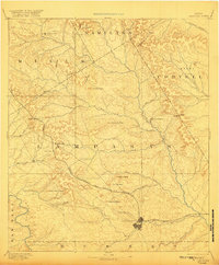
1894 Map of Lampasas
USGS Topo · Published 1920About this map
The Gulf Colorado and Santa Fe Railroad cuts a winding path through the heart of Central Texas, anchoring the growing regional hub at Lampasas. Surveyed in the 1880s, this landscape reflects a period of early settlement defined by numerous topographic gaps used for transit, such as Paynes Gap and Antelope Gap, and the establishment of local industrial sites like Townsen Mills. The map captures several small communities and post offices including Senterfitt, Centre City, and the curiously named Wayback. High peaks and ridges dominate the skyline, notably Castle Peak and Kinchelo Peak, while a dense network of waterways including Simms Creek and Cowhouse Creek feed the Leon River. The terrain is characterized by numerous family-named landmarks and peaks that indicate the early ranching and farming footprint of the Lampasas and Hamilton county lines.
Find a feature on this map
50 named features on this map. Tap any name to fly to it.
Don’t see what you’re looking for? This feature index may not catch every label — zoom into the map to look around manually.
Map Details
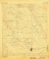
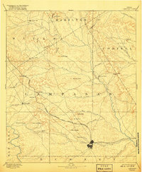
Editions of this 1894 Lampasas Map
4 editions found

Other maps of this area

1885 · San Saba
USGS Topo · 1:125,000

1887 · Llano
USGS Topo · 1:125,000

1887 · Lampasas
USGS Topo · 1:125,000

1887 · Burnet
USGS Topo · 1:125,000

1888 · Hamilton
USGS Topo · 1:125,000

1888 · Meridian
USGS Topo · 1:125,000

1889 · Brownwood
USGS Topo · 1:125,000

1893 · Georgetown
USGS Topo · 1:125,000

1893 · Burnet
USGS Topo · 1:125,000

1894 · Hamilton
USGS Topo · 1:125,000