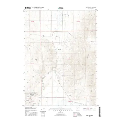
2017 Map of Lampo Junction
USGS Topo · Published 2017About this map
The Golden Spike National Historic Site dominates the southern reaches of this landscape, marking the historic convergence of the first transcontinental railroad. This modern survey illustrates how the land has been preserved and utilized since that 1869 milestone, featuring the Big Fill Trail and the E Auto Tour Route traversing the base of the Promontory Mountains. To the north, the settlement of Howell and the crossroads at Lampo Junction anchor a valley defined by agricultural roads and the seasonal flow of Blue Cr.
Find a feature on this map
28 named features on this map. Tap any name to fly to it.
Don’t see what you’re looking for? This feature index may not catch every label — zoom into the map to look around manually.
Map Details
Editions of this 2017 Lampo Junction Map
This is the sole edition of this map. No revisions or reprints were ever made.
Other maps of this area

1954 · Public Shooting Grounds
USGS Topo · 1:24,000

1954 · Brigham City
USGS Topo · 1:250,000

1958 · Brigham City
USGS Topo · 1:250,000

1961 · Thatcher Mountain
USGS Topo · 1:62,500

1962 · Brigham City
USGS Topo · 1:250,000

1966 · Thatcher Mountain SW
USGS Topo · 1:24,000

1967 · Golden Spike Monument
USGS Topo · 1:24,000

1968 · Sunset Pass
USGS Topo · 1:24,000

1968 · Howell
USGS Topo · 1:24,000
1968 · Blind Springs
USGS Topo · 1:24,000