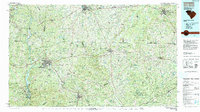
1986 Map of Lancaster
USGS Topo · Published 1991About this map
The Catawba River corridor defines the western edge of this mid-1980s landscape, where industrial and recreational water features like Lake Wylie and the Fishing Creek Reservoir meet the historical footprints of the Southern Railway and Seaboard System Railroad. The transition from the Piedmont to the Atlantic Coastal Plain is marked by the unique geology of the Sandhills and landmarks such as Forty Acre Rock and Sugarloaf Mountain.
Find a feature on this map
113 named features on this map. Tap any name to fly to it.
Don’t see what you’re looking for? This feature index may not catch every label — zoom into the map to look around manually.
Map Details
Editions of this 1986 Lancaster Map
2 editions found
Other maps of this area

1904 · Columbia
USGS Topo · 1:125,000

1905 · Charlotte
USGS Topo · 1:48,000

1907 · Charlotte
USGS Topo · 1:62,500

1935 · Camden
USGS Topo · 1:48,000

1938 · Camden
USGS Topo · 1:62,500

1941 · Charlotte
USGS Topo · 1:125,000

1941 · Spartanburg
USGS Topo · 1:250,000

1942 · Troy
USGS Topo · 1:125,000

1942 · Charlotte
USGS Topo · 1:125,000

1942 · Camden
USGS Topo · 1:125,000