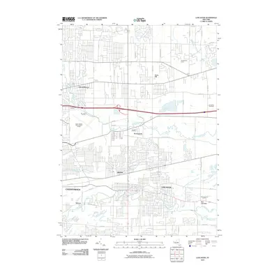
2010 Map of Lancaster
USGS Topo · Published 2010About this map
Ellicott Creek and Cayuga Creek define the drainage of this suburban landscape east of Buffalo at the start of the 21st century. The map documents a dense network of residential and industrial development concentrated around the village centers of Williamsville, Depew, and Lancaster. For genealogists and local historians, several burial sites are clearly marked, most notably the War of 1812 Cemetery and the Transit Rural Cemetery near Bowmansville. The transit-heavy nature of the region is evident in the sprawling grounds of the Greater Buffalo International Airport and the prominent path of Interstate 90. Further east, the character shifts slightly toward local recreation and industry, shown by the Lancaster Speedway and smaller communities like Harris Hill and East Lancaster.
Find a feature on this map
56 named features on this map. Tap any name to fly to it.
Don’t see what you’re looking for? This feature index may not catch every label — zoom into the map to look around manually.
Map Details
Editions of this 2010 Lancaster Map
This is the sole edition of this map. No revisions or reprints were ever made.
Other maps of this area

1894 · Buffalo
USGS Topo · 1:62,500

1897 · Tonawanda
USGS Topo · 1:62,500

1897 · Lockport
USGS Topo · 1:62,500

1899 · Niagara
USGS Topo · 1:125,000

1900 · Tonawanda
USGS Topo · 1:62,500

1901 · Buffalo
USGS Topo · 1:62,500

1901 · Tonawanda
USGS Topo · 1:62,500

1902 · Lockport
USGS Topo · 1:62,500

1905 · Depew
USGS Topo · 1:62,500

1905 · Lockport
USGS Topo · 1:62,500