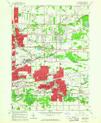
1965 Map of Lancaster
USGS Topo · Published 1967About this map
Ellicott Creek and Cayuga Creek carve through this mid-1960s landscape, where suburban expansion meets long-standing railroad infrastructure. The map documents a pivotal era of growth in Erie County, centered on the villages of Lancaster, Depew, and Williamsville. This period is defined by the massive footprint of the Greater Buffalo International Airport and the heavy rail corridors of the Lehigh Valley Railroad, Erie-Lackawanna Railroad, and New York Central Railroad.
Find a feature on this map
75 named features on this map. Tap any name to fly to it.
Don’t see what you’re looking for? This feature index may not catch every label — zoom into the map to look around manually.
Map Details
Editions of this 1965 Lancaster Map
This is the sole edition of this map. No revisions or reprints were ever made.
Other maps of this area

1894 · Buffalo
USGS Topo · 1:62,500

1897 · Tonawanda
USGS Topo · 1:62,500

1897 · Lockport
USGS Topo · 1:62,500

1899 · Niagara
USGS Topo · 1:125,000

1900 · Tonawanda
USGS Topo · 1:62,500

1901 · Buffalo
USGS Topo · 1:62,500

1901 · Tonawanda
USGS Topo · 1:62,500

1902 · Lockport
USGS Topo · 1:62,500

1905 · Depew
USGS Topo · 1:62,500

1905 · Lockport
USGS Topo · 1:62,500