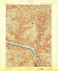
1908 Map of Lancaster
USGS Topo · Published 1932About this map
Lancaster serves as the central hub of this turn-of-the-century survey, situated amidst the deeply dissected plateaus of Grant County. The landscape is defined by the winding course of the Grant River and Platte River, which carve through the terrain toward their confluence with the Mississippi River. This era shows a robust transportation network where the Chicago and Northwestern RR and Chicago Milwaukee and St Paul RR navigate the ridge-lines and river valleys to connect agricultural centers like Fennimore and Bloomington.
Find a feature on this map
88 named features on this map. Tap any name to fly to it.
Don’t see what you’re looking for? This feature index may not catch every label — zoom into the map to look around manually.
Map Details
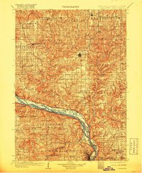
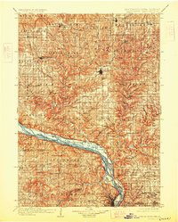
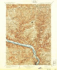
Editions of this 1908 Lancaster Map
5 editions found
Other maps of this area

1900 · Anamosa
USGS Topo · 1:125,000

1900 · Lancaster
USGS Topo · 1:125,000

1901 · Peosta
USGS Topo · 1:125,000

1902 · Mineral Point
USGS Topo · 1:125,000

1902 · Elkader
USGS Topo · 1:125,000

1903 · Waukon
USGS Topo · 1:125,000

1904 · Lancaster
USGS Topo · 1:125,000

1905 · Richland Center
USGS Topo · 1:125,000

1908 · Lancaster
USGS Topo · 1:125,000

1911 · Galena
USGS Topo · 1:62,500