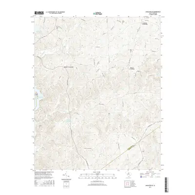
2017 Map of Lancaster SE
USGS Topo · Published 2017About this map
Cauthens Crossroads and Blakley Crossroads serve as central nodes in this rural South Carolina landscape where Lancaster Co and Kershaw Co meet. The geography is defined by a dense network of waterways including Camp Creek, Dry Cr, and Rocky Cr, all flowing toward the reservoir systems of the west. These drainage patterns influenced the placement of numerous family and community landmarks, such as Camp Creek Cem and Mackey Walker Cem, which are scattered throughout the interior.
Find a feature on this map
57 named features on this map. Tap any name to fly to it.
Don’t see what you’re looking for? This feature index may not catch every label — zoom into the map to look around manually.
Map Details
Editions of this 2017 Lancaster SE Map
This is the sole edition of this map. No revisions or reprints were ever made.
Other maps of this area

1935 · Camden
USGS Topo · 1:48,000

1938 · Camden
USGS Topo · 1:62,500

1941 · Spartanburg
USGS Topo · 1:250,000

1942 · Camden
USGS Topo · 1:125,000

1953 · Spartanburg
USGS Topo · 1:250,000

1960 · Spartanburg
USGS Topo · 1:250,000

1963 · Spartanburg
USGS Topo · 1:250,000

1964 · Spartanburg
USGS Topo · 1:250,000

1968 · Lancaster SE
USGS Topo · 1:24,000

1968 · Heath Springs
USGS Topo · 1:24,000