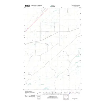
2011 Map of Lance Hills
USGS Topo · Published 2011About this map
Malloy Prairie and the eponymous Lance Hills define this corner of Spokane County, where the landscape is etched by the winding path of Hog Canyon Creek. In the early 21st century, this area remains characterized by rural expanses punctuated by small community nodes such as Babb, Geib, and Mock. Local history is anchored by the Harmony School and the Lance Hill Cemetery, reflecting the institutional roots of the surrounding countryside. The terrain is notably water-rich, featuring a cluster of small lakes including Alkali Lake, Bunn Lake, and Ballinger Lake. A network of named local roads like W Lance Hill Rd and S Phillips Rd provide access to these isolated prairies and hills, documenting the persistent settlement patterns in this part of Washington.
Find a feature on this map
43 named features on this map. Tap any name to fly to it.
Don’t see what you’re looking for? This feature index may not catch every label — zoom into the map to look around manually.
Map Details
Editions of this 2011 Lance Hills Map
This is the sole edition of this map. No revisions or reprints were ever made.
Other maps of this area

1943 · Medical Lake
USGS Topo · 1:62,500

1945 · Reardan
USGS Topo · 1:62,500

1953 · Reardan
USGS Topo · 1:62,500

1954 · Medical Lake
USGS Topo · 1:24,000

1954 · Medical Lake
USGS Topo · 1:62,500

1954 · Cheney
USGS Topo · 1:62,500
1954 · Four Lakes
USGS Topo · 1:24,000

1954 · Sprague
USGS Topo · 1:62,500

1955 · Spokane
USGS Topo · 1:250,000

1958 · Spokane
USGS Topo · 1:250,000