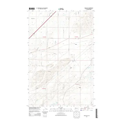
2014 Map of Lance Hills
USGS Topo · Published 2014About this map
Malloy Prairie anchors the northern reaches of this Spokane County landscape, giving way to a complex series of ridges and depressions. The eponymous Lance Hills rise prominently in the central section, flanked by a network of small, scattered water bodies including Campbell Lake, Ballinger Lake, and Alkali Lake. These glacial-carved features define the character of the terrain, interspersed with local summits such as Bunker Hill.
Find a feature on this map
41 named features on this map. Tap any name to fly to it.
Don’t see what you’re looking for? This feature index may not catch every label — zoom into the map to look around manually.
Map Details
Editions of this 2014 Lance Hills Map
This is the sole edition of this map. No revisions or reprints were ever made.
Other maps of this area

1943 · Medical Lake
USGS Topo · 1:62,500

1945 · Reardan
USGS Topo · 1:62,500

1953 · Reardan
USGS Topo · 1:62,500

1954 · Medical Lake
USGS Topo · 1:24,000

1954 · Medical Lake
USGS Topo · 1:62,500

1954 · Cheney
USGS Topo · 1:62,500
1954 · Four Lakes
USGS Topo · 1:24,000

1954 · Sprague
USGS Topo · 1:62,500

1955 · Spokane
USGS Topo · 1:250,000

1958 · Spokane
USGS Topo · 1:250,000