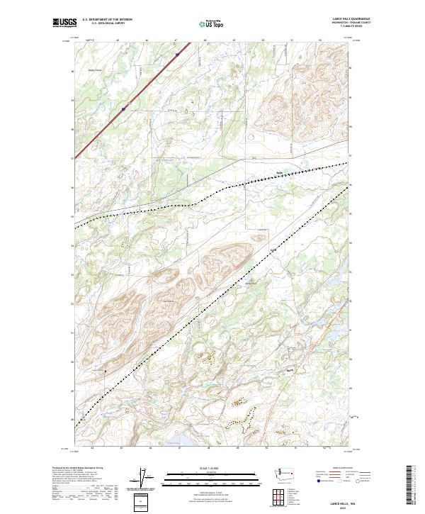
2023 Map of Lance Hills
USGS Topo · Published 2023About this map
Turnbull National Wildlife Refuge dominates the eastern portion of this landscape in Spokane County, protecting a distinct complex of wetlands and basalt outcrops. The terrain is defined by the Lance Hills and Bunker Hill, where the drainage of Hog Canyon Creek carves through the volcanic geology typical of the Inland Northwest. Small water bodies like Mud Lake, Bunn Lake, and Alkali Lake are scattered across the quadrangle, illustrating the scabland hydrology that has shaped local land use for generations.
Find a feature on this map
45 named features on this map. Tap any name to fly to it.
Don’t see what you’re looking for? This feature index may not catch every label — zoom into the map to look around manually.
Map Details
Editions of this 2023 Lance Hills Map
This is the sole edition of this map. No revisions or reprints were ever made.
Other maps of this area

1943 · Medical Lake
USGS Topo · 1:62,500

1945 · Reardan
USGS Topo · 1:62,500

1953 · Reardan
USGS Topo · 1:62,500

1954 · Medical Lake
USGS Topo · 1:24,000

1954 · Medical Lake
USGS Topo · 1:62,500

1954 · Cheney
USGS Topo · 1:62,500
1954 · Four Lakes
USGS Topo · 1:24,000

1954 · Sprague
USGS Topo · 1:62,500

1955 · Spokane
USGS Topo · 1:250,000

1958 · Spokane
USGS Topo · 1:250,000