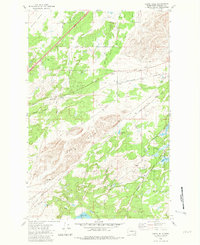
1980 Map of Lance Hills
USGS Topo · Published 1981About this map
The Lance Hills and the adjacent Malloy Prairie define a landscape shaped by glacial activity and drainage patterns southwest of Spokane. By the early 1980s, this area maintained a balance between conservation and infrastructure, notably where the Turnbull National Wildlife Refuge encompasses wetland features like Ballinger Lake and Turnbull Slough. The Burlington Northern railroad cuts through the center of the sheet, providing a vital transportation artery that parallels Hog Canyon.
Find a feature on this map
27 named features on this map. Tap any name to fly to it.
Don’t see what you’re looking for? This feature index may not catch every label — zoom into the map to look around manually.
Map Details
Editions of this 1980 Lance Hills Map
This is the sole edition of this map. No revisions or reprints were ever made.
Other maps of this area

1943 · Medical Lake
USGS Topo · 1:62,500

1945 · Reardan
USGS Topo · 1:62,500

1953 · Reardan
USGS Topo · 1:62,500

1954 · Medical Lake
USGS Topo · 1:24,000

1954 · Medical Lake
USGS Topo · 1:62,500

1954 · Cheney
USGS Topo · 1:62,500
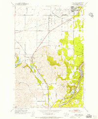
1954 · Four Lakes
USGS Topo · 1:24,000

1954 · Sprague
USGS Topo · 1:62,500

1955 · Spokane
USGS Topo · 1:250,000

1958 · Spokane
USGS Topo · 1:250,000