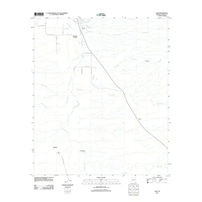
2011 Map of Land
USGS Topo · Published 2011About this map
The San Pedro River forms the central spine of this high desert landscape in Cochise County, anchoring a series of small outposts and crossings including Escalante Crossing and the settlement of Land. In the south, the map identifies Contention and Boquillas, names that recall the region's ranching and mining history. The presence of the Saint David Cemetery and the Kellar Ranch provides specific points of interest for genealogists tracing early Arizona families.
Find a feature on this map
28 named features on this map. Tap any name to fly to it.
Don’t see what you’re looking for? This feature index may not catch every label — zoom into the map to look around manually.
Map Details
Editions of this 2011 Land Map
This is the sole edition of this map. No revisions or reprints were ever made.
Other maps of this area

1915 · Benson
USGS Topo · 1:125,000

1922 · St. David
USGS Topo · 1:62,500

1926 · Whetstone
USGS Topo · 1:62,500

1932 · Fairbank
USGS Topo · 1:62,500

1938 · Huachuca
USGS Topo · 1:62,500

1943 · Benson
USGS Topo · 1:125,000

1948 · Fort Huachuca NE
USGS Topo · 1:24,000
1948 · Fort Huachuca
USGS Topo · 1:62,500
1952 · Fairbank
USGS Topo · 1:24,000
1952 · Tombstone
USGS Topo · 1:24,000