
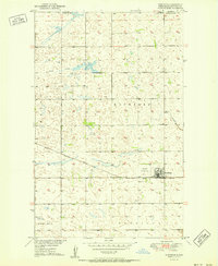
1950 Map of Landa
USGS Topo · Published 1950About this map
The Souris River meanders southward from the Canada United States border, defining the center of this landscape in North Dakota's Bottineau County. This 1950 survey highlights the Lower Souris National Wildlife Refuge, which encompasses the river valley and its surrounding wetlands. The town of Landa is situated in the southeastern portion of the map, serving as a hub for the local agricultural community. Transport and infrastructure are dominated by the Great Northern railroad line, which skirts the refuge and connects the town to the broader region. Local social landmarks, such as Zion Ch, School No 1, and School No 2, are scattered throughout the surrounding townships of Scotia and Eidsvold, providing a detailed look at the rural settlement patterns before mid-century modernization.
Find a feature on this map
20 named features on this map. Tap any name to fly to it.
Don’t see what you’re looking for? This feature index may not catch every label — zoom into the map to look around manually.
Map Details
Editions of this 1950 Landa Map
This is the sole edition of this map. No revisions or reprints were ever made.
Other maps of this area

1949 · Landa
USGS Topo · 1:24,000

1949 · Landa SW
USGS Topo · 1:24,000

1950 · Landa SW
USGS Topo · 1:24,000

1951 · Westhope SE
USGS Topo · 1:24,000
1951 · Westhope
USGS Topo · 1:24,000

1954 · Landa SE
USGS Topo · 1:24,000

1954 · Roth
USGS Topo · 1:24,000

1954 · Minot
USGS Topo · 1:250,000

1958 · Minot
USGS Topo · 1:250,000

1980 · Bottineau
USGS Topo · 1:100,000