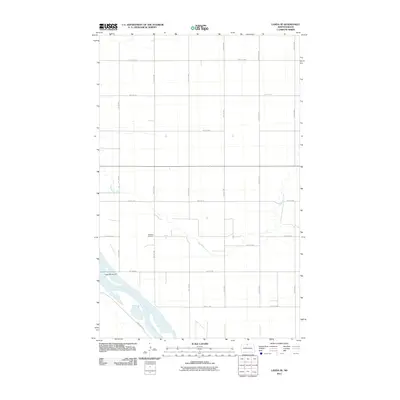
2011 Map of Landa SE
USGS Topo · Published 2011About this map
Nedaros Cemetery sits as a quiet landmark amidst the agricultural grid of Bottineau County, just north of the winding course of the Souris River. This 2011 survey reveals a landscape defined by its waterways and a strictly organized section-line road system. The Souris River and its tributary, Boundary Creek, create the primary relief in an otherwise flat prairie expanse, with the river's flow managed by structures such as Dam Number 84. The map provides a contemporary record of rural infrastructure, tracing routes like County Rd 33 and Grassland Trl that connect scattered homesteads and fields. The intersection of natural watercourses with the precise geometry of North Dakota's section lines illustrates the enduring spatial organization of the northern plains, where burial sites like Nedaros remain vital links to the area's early settlement history.
Find a feature on this map
20 named features on this map. Tap any name to fly to it.
Don’t see what you’re looking for? This feature index may not catch every label — zoom into the map to look around manually.
Map Details
Editions of this 2011 Landa SE Map
This is the sole edition of this map. No revisions or reprints were ever made.
Other maps of this area

1949 · Landa
USGS Topo · 1:24,000

1949 · Landa SW
USGS Topo · 1:24,000

1949 · Kramer
USGS Topo · 1:24,000

1950 · Newburg
USGS Topo · 1:24,000

1950 · Kramer
USGS Topo · 1:24,000

1950 · Deep
USGS Topo · 1:24,000

1950 · Landa
USGS Topo · 1:24,000

1950 · Landa SW
USGS Topo · 1:24,000

1954 · Souris SW
USGS Topo · 1:24,000

1954 · Landa SE
USGS Topo · 1:24,000