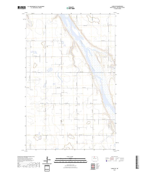
2024 Map of Landa SW
USGS Topo · Published 2024About this map
The Souris River carves a significant wetland corridor through the prairie of Bottineau County, where the J. Clark Salyer National Wildlife Refuge dominates the eastern half of the landscape. This protected riverine environment preserves a complex network of marshes and open water, contrasting sharply with the rigid section-line road system that organizes the surrounding agricultural uplands. The terrain is marked by subtle elevation changes along the river valley, with Boundary Creek entering from the east near the northern bend of the refuge. A strictly rural grid of gravel routes, including 97th St NW and Co Rd 27B, facilitates movement through the grain fields and pasturelands that characterize this border region of North Dakota.
Find a feature on this map
22 named features on this map. Tap any name to fly to it.
Don’t see what you’re looking for? This feature index may not catch every label — zoom into the map to look around manually.
Map Details
Editions of this 2024 Landa SW Map
This is the sole edition of this map. No revisions or reprints were ever made.
Other maps of this area

1949 · Eckman
USGS Topo · 1:24,000

1949 · Landa
USGS Topo · 1:24,000

1949 · Landa SW
USGS Topo · 1:24,000

1950 · Newburg
USGS Topo · 1:24,000

1950 · Deep
USGS Topo · 1:24,000

1950 · Landa
USGS Topo · 1:24,000

1950 · Landa SW
USGS Topo · 1:24,000

1951 · Westhope SE
USGS Topo · 1:24,000
1951 · Westhope
USGS Topo · 1:24,000

1954 · Landa SE
USGS Topo · 1:24,000