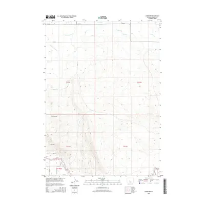
2015 Map of Lander NW
USGS Topo · Published 2015About this map
The North Popo Agie River and Popo Agie River anchor the southern landscape of this Fremont County quadrangle, where the waterways meet a grid of rural lanes and irrigation works. The terrain is defined by the Sand Hills and the deep incision of Sharp Nose Draw, showing a complex system of water management. A network of man-made waterways, including Coolidge Ditch, Sioux Ditch, and the Hansen Drain, illustrates the area's agricultural reliance on diverted river water. Local transit is marked by numbered and family-named routes such as Ethete Rd, Plunkett Rd, and Obrien Rd. This layout reveals how the natural drainage of Mill Cr has been augmented by extensive infrastructure like the Hansen Drain Extension to support the high plains environment.
Find a feature on this map
27 named features on this map. Tap any name to fly to it.
Don’t see what you’re looking for? This feature index may not catch every label — zoom into the map to look around manually.
Map Details
Editions of this 2015 Lander NW Map
This is the sole edition of this map. No revisions or reprints were ever made.
Other maps of this area

1951 · Mule Butte
USGS Topo · 1:24,000

1951 · Pavillion SE
USGS Topo · 1:24,000

1951 · Ethete
USGS Topo · 1:24,000

1952 · Hudson
USGS Topo · 1:24,000

1952 · Ray Lake
USGS Topo · 1:24,000

1952 · Lander SE
USGS Topo · 1:24,000

1952 · Lander
USGS Topo · 1:24,000

1952 · Lander NW
USGS Topo · 1:24,000

1953 · Mount Arter SE
USGS Topo · 1:24,000

1955 · Thermopolis
USGS Topo · 1:250,000