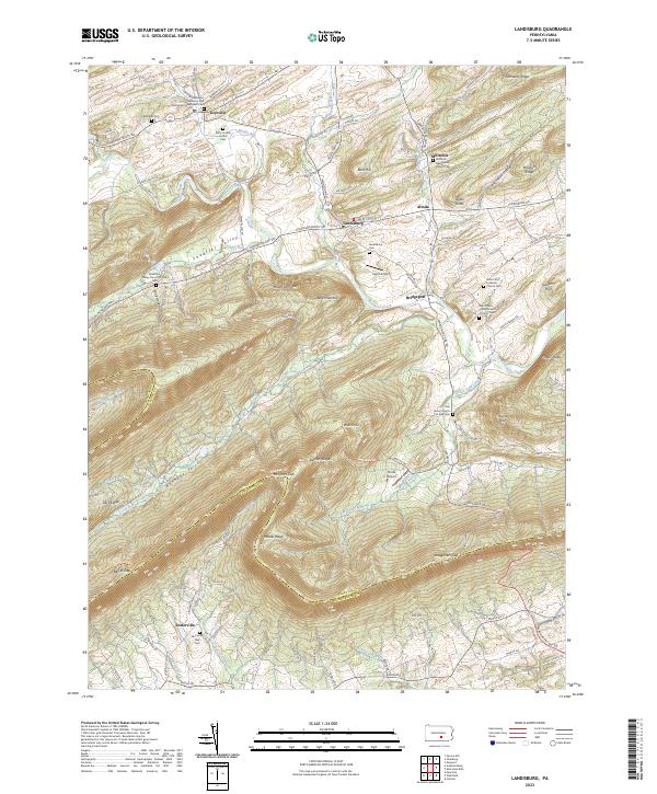
2023 Map of Landisburg
USGS Topo · Published 2023About this map
Shermans Creek winds through this central Pennsylvania landscape, anchoring the historic settlements of Landisburg, Loysville, and Bridgeport. The terrain is defined by a series of prominent ridges, including Blue Mountain and Pisgah Ridge, which separate the agricultural valleys. This 2023 survey documents a high density of rural religious and funerary sites, such as the Lebanon Lutheran and Reformed Churchyard Cem and the Milltown Mennonite Church Cem, reflecting the deep-rooted community history of the region.
Find a feature on this map
105 named features on this map. Tap any name to fly to it.
Don’t see what you’re looking for? This feature index may not catch every label — zoom into the map to look around manually.
Map Details
Editions of this 2023 Landisburg Map
This is the sole edition of this map. No revisions or reprints were ever made.
Other maps of this area

1904 · Carlisle
USGS Topo · 1:62,500

1907 · New Bloomfield
USGS Topo · 1:62,500

1919 · Newville
USGS Topo · 1:62,500

1930 · Loysville
USGS Topo · 1:62,500

1933 · Loysville
USGS Topo · 1:62,500

1943 · New Bloomfield
USGS Topo · 1:62,500

1943 · Carlisle
USGS Topo · 1:62,500

1945 · Newville
USGS Topo · 1:62,500

1950 · Harrisburg
USGS Topo · 1:250,000
1952 · Spruce Hill
USGS Topo · 1:24,000
Featured Places
- Saville Township, PA
- Landisburg, PA
- Tyrone Township, PA
- Northeast Madison Township, PA
- Southwest Madison Township, PA