
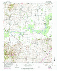
1952 Map of Lane
USGS Topo · Published 1953About this map
The Obion River meanders through this West Tennessee landscape, defining the boundary between Obion Co and Dyer Co. The river valley is marked by its abandoned channels and oxbows, preserved as Horseshoe Lake, Round Lake, and Old River Lake. Settlement patterns in the early 1950s follow the higher ground above the floodplain, where small rural communities like Cloverdale and Maxey serve as anchors for local life. This period shows a well-distributed network of country institutions, including Cloverdale School and Glendale School. Local genealogy is deeply rooted in the numerous rural congregations such as Zion Church and Emmaus Church, which often stand alongside family-named sites like Zion Cemetery and Banks Cemetery. The persistence of river crossings is noted at Sharps Ferry, a lingering connection to the region's historic transportation routes before modern infrastructure fully bypassed the wetlands.
Find a feature on this map
39 named features on this map. Tap any name to fly to it.
Don’t see what you’re looking for? This feature index may not catch every label — zoom into the map to look around manually.
Map Details
Editions of this 1952 Lane Map
2 editions found
Other maps of this area

1925 · Reelfoot Lake
USGS Topo · 1:62,500

1939 · Reelfoot Lake
USGS Topo · 1:62,500

1939 · Dyersburg
USGS Topo · 1:62,500

1950 · Obion
USGS Topo · 1:24,000

1951 · Obion
USGS Topo · 1:24,000

1952 · Newbern
USGS Topo · 1:24,000

1952 · Dyersburg
USGS Topo · 1:24,000

1952 · Miston
USGS Topo · 1:24,000

1956 · Reelfoot Lake
USGS Topo · 1:62,500

1956 · Dyersburg
USGS Topo · 1:250,000