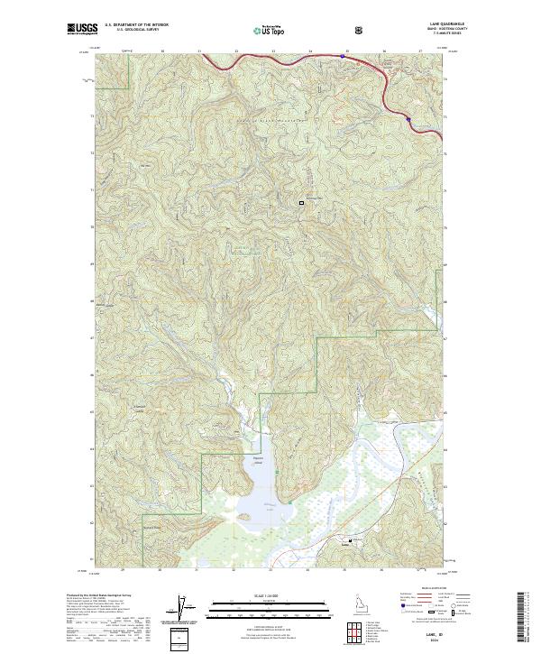
2024 Map of Lane
USGS Topo · Published 2024About this map
Killarney Lake and the Coeur d'Alene River anchor this survey of Northern Idaho, where the water system meets the steep rising slopes of the Coeur d'Alene Mountains. The settlement of Lane is situated near the riverbanks, serving as a focal point for local history along with the nearby Lane Cem. This area within the Coeur d'Alene National Forest is defined by its drainage network, including Chatfield Creek, Fortier Creek, and Varnum Creek, which carve deep draws into the landscape. High points like Killarney Mtn and Elk Mtn dominate the horizon, while the Trail Of The Coeur D' Alene S Trl follows the river corridor, marking a modern use for the valley's natural thoroughfare. The map also identifies local geography such as Popcorn Island and the prominent Fourth of July Summit to the north.
Find a feature on this map
50 named features on this map. Tap any name to fly to it.
Don’t see what you’re looking for? This feature index may not catch every label — zoom into the map to look around manually.
Map Details
Editions of this 2024 Lane Map
This is the sole edition of this map. No revisions or reprints were ever made.
Other maps of this area

1903 · Rathdrum
USGS Topo · 1:125,000

1909 · Cataldo
USGS Topo · 1:125,000

1911 · Cataldo
USGS Topo · 1:125,000

1950 · Rochat Peak
USGS Topo · 1:24,000

1952 · Rochat Peak
USGS Topo · 1:24,000

1955 · Spokane
USGS Topo · 1:250,000

1957 · St. Maries
USGS Topo · 1:62,500

1957 · Kingston
USGS Topo · 1:62,500

1957 · Lane
USGS Topo · 1:62,500

1957 · St. Joe
USGS Topo · 1:62,500