
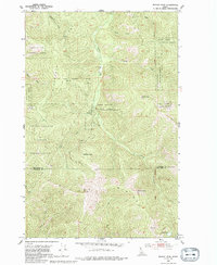
1950 Map of Rochat Peak
USGS Topo · Published 1976About this map
Coeur d'Alene Indian Reservation lands dominate the western half of this 1950s-era landscape, where the Former Boundary Coeur d'Alene Indian Reservation line is clearly delineated across the northern ridges. The terrain is defined by the high crest of the St Joe Divide, which separates the drainages of the Coeur d'Alene National Forest and the St Joe National Forest. Prominent summits like Rochat Peak and Kootenai Peak anchor the central topography, providing a detailed view of the remote northern Idaho wilderness before modern development. High-altitude landmarks such as Eagle Lookout and the secluded Crystal Lake are noted along the steep slopes of Black Rock Ridge. Numerous watercourses, including Latour Creek and Robinson Creek, carve through the valleys, following the natural survey lines of the Boise Meridian.
Find a feature on this map
24 named features on this map. Tap any name to fly to it.
Don’t see what you’re looking for? This feature index may not catch every label — zoom into the map to look around manually.
Map Details
Editions of this 1950 Rochat Peak Map
2 editions found
Other maps of this area

1903 · Rathdrum
USGS Topo · 1:125,000

1909 · Cataldo
USGS Topo · 1:125,000

1911 · Cataldo
USGS Topo · 1:125,000

1950 · Twin Crags
USGS Topo · 1:24,000

1952 · Rochat Peak
USGS Topo · 1:24,000

1952 · Twin Crags
USGS Topo · 1:24,000

1955 · Spokane
USGS Topo · 1:250,000

1957 · St. Maries
USGS Topo · 1:62,500

1957 · Kingston
USGS Topo · 1:62,500

1957 · Lane
USGS Topo · 1:62,500