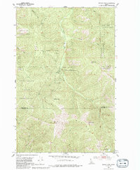
1950 Map of Rochat Peak
USGS Topo · Published 1992About this map
St Joe Divide anchors this mid-century topographic study, marking the high-altitude boundary between Kootenai and Benewah counties. The landscape is dominated by the sprawling timberlands of the Coeur d'Alene National Forest, where steep drainages like Blackrock Gulch and Larch Creek define the vertical relief. A significant historical line, the Old Indian Reservation Boundary, cuts through the northern sections, separating the forest from the Coeur d'Alene Indian Reservation and reflecting the evolving administrative history of the region's land use.
Find a feature on this map
23 named features on this map. Tap any name to fly to it.
Don’t see what you’re looking for? This feature index may not catch every label — zoom into the map to look around manually.
Map Details
Editions of this 1950 Rochat Peak Map
2 editions found
Other maps of this area

1903 · Rathdrum
USGS Topo · 1:125,000

1909 · Cataldo
USGS Topo · 1:125,000

1911 · Cataldo
USGS Topo · 1:125,000

1950 · Rochat Peak
USGS Topo · 1:24,000

1950 · Twin Crags
USGS Topo · 1:24,000

1952 · Rochat Peak
USGS Topo · 1:24,000

1952 · Twin Crags
USGS Topo · 1:24,000

1955 · Spokane
USGS Topo · 1:250,000

1957 · St. Maries
USGS Topo · 1:62,500

1957 · Kingston
USGS Topo · 1:62,500