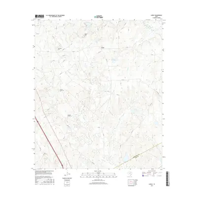
2016 Map of Lanely
USGS Topo · Published 2016About this map
Lanely sits at the center of this rural landscape where Freestone and Leon Counties meet, serving as a hub for local routes like FM 489 and FM 1848. The terrain is defined by a dense network of tributaries including Plum Cr, Browns Cr, and Cedar Cr that feed into larger bottomlands. These watercourses have long shaped the agricultural and social layout of the region, from the northern Folsom Hills down to Chandler Bottom in the south.
Find a feature on this map
52 named features on this map. Tap any name to fly to it.
Don’t see what you’re looking for? This feature index may not catch every label — zoom into the map to look around manually.
Map Details
Editions of this 2016 Lanely Map
This is the sole edition of this map. No revisions or reprints were ever made.
Other maps of this area

1919 · Fairfield
USGS Topo · 1:62,500

1953 · Palestine
USGS Topo · 1:250,000

1954 · Waco
USGS Topo · 1:250,000

1955 · Waco
USGS Topo · 1:250,000

1956 · Jewett
USGS Topo · 1:62,500

1957 · Palestine
USGS Topo · 1:250,000

1964 · Flo
USGS Topo · 1:24,000

1964 · Keechi
USGS Topo · 1:24,000
1964 · Butler
USGS Topo · 1:24,000

1965 · Dew
USGS Topo · 1:24,000