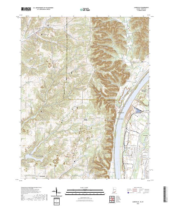
2022 Map of Lanesville
USGS Topo · Published 2022About this map
Lanesville and its surrounding uplands in southern Indiana overlook the Ohio River, where the landscape is defined by the sharp transition from the Indiana plateau to the river valley floor. The upland terrain is heavily dissected by drainage systems like Smith Cr and Middle Fork Buck Cr, which have carved out deep hollows and ridges such as Sampson Hollow and Brock Ridge. This 2022 survey documents a dense concentration of early family and community burial sites, including the Lanesville Protestant Cem, Shoemaker Tuell Cem, and Hopewell Cem, which provide significant anchor points for local genealogical research. Across the river in Kentucky, the industrial and residential corridors of Sylvania and Greenwood contrast with the rural character of the Harrison County side. Settlement patterns follow the high ground and ridge lines, with small communities like Lottick Corner and Seven Springs established away from the floodplain, while Locust Point and Bridgeport sit directly along the river bank.
Find a feature on this map
145 named features on this map. Tap any name to fly to it.
Don’t see what you’re looking for? This feature index may not catch every label — zoom into the map to look around manually.
Map Details
Editions of this 2022 Lanesville Map
This is the sole edition of this map. No revisions or reprints were ever made.
Other maps of this area

1909 · Kosmosdale
USGS Topo · 1:48,000

1912 · Kosmosdale
USGS Topo · 1:62,500

1931 · Corydon
USGS Topo · 1:62,500

1939 · New Albany
USGS Topo · 1:24,000

1939 · Georgetown
USGS Topo · 1:24,000

1946 · New Albany
USGS Topo · 1:24,000

1947 · Georgetown
USGS Topo · 1:24,000

1948 · Corydon East
USGS Topo · 1:24,000

1948 · Laconia
USGS Topo · 1:24,000

1949 · Georgetown
USGS Topo · 1:24,000