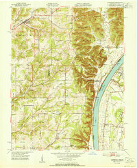
1951 Map of Lanesville
USGS Topo · Published 1951About this map
The town of Lanesville sits amidst the complex drainage patterns of Indian Creek and Panther Creek in this mid-century survey of Harrison County. The landscape is defined by its distinct ridges and knobs, such as Hickman Hill and Pigeon Roost, which drop sharply toward the Ohio River to the east. Navigational markers like Beelers Lt and Hellmans Point along the riverbank indicate the importance of the waterway to the region's transport network.
Find a feature on this map
77 named features on this map. Tap any name to fly to it.
Don’t see what you’re looking for? This feature index may not catch every label — zoom into the map to look around manually.
Map Details
Editions of this 1951 Lanesville Map
2 editions found
Other maps of this area

1909 · Kosmosdale
USGS Topo · 1:48,000

1912 · Kosmosdale
USGS Topo · 1:62,500

1931 · Corydon
USGS Topo · 1:62,500

1939 · New Albany
USGS Topo · 1:24,000

1939 · Georgetown
USGS Topo · 1:24,000

1946 · New Albany
USGS Topo · 1:24,000

1947 · Georgetown
USGS Topo · 1:24,000

1948 · Corydon East
USGS Topo · 1:24,000

1948 · Laconia
USGS Topo · 1:24,000

1949 · Georgetown
USGS Topo · 1:24,000