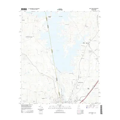
2014 Map of Lanett North
USGS Topo · Published 2014About this map
West Point Lake dominates the center of this 2014 survey, where the waters of the Chattahoochee River define the boundary between Alabama and Georgia. The landscape is a network of dendritic inlets and family-named landmarks, tracing the modern shoreline around Hairston Island and Piedmont Heights. To the south, the industrial and residential corridors of Lanett and West Point converge, showing the intricate street grids of North West Point and the newer developments of Tyler Estates.
Find a feature on this map
104 named features on this map. Tap any name to fly to it.
Don’t see what you’re looking for? This feature index may not catch every label — zoom into the map to look around manually.
Map Details
Editions of this 2014 Lanett North Map
This is the sole edition of this map. No revisions or reprints were ever made.
Other maps of this area

1899 · Wedowee
USGS Topo · 1:125,000

1902 · Wedowee
USGS Topo · 1:125,000

1907 · Opelika
USGS Topo · 1:125,000

1909 · Opelika
USGS Topo · 1:125,000

1953 · Atlanta
USGS Topo · 1:250,000

1955 · Phenix City
USGS Topo · 1:250,000

1957 · Phenix City
USGS Topo · 1:250,000

1957 · Atlanta
USGS Topo · 1:250,000

1958 · Phenix City
USGS Topo · 1:250,000

1958 · Atlanta
USGS Topo · 1:250,000