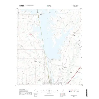
2018 Map of Lanett North
USGS Topo · Published 2018About this map
West Point Lake dominates the upper half of this modern topographical study, its complex shoreline and inlets reaching into both Chambers County, Alabama, and Troup County, Georgia. This massive reservoir on the Chattahoochee River altered the local geography, creating features like Hairston Island and The Island while submerging the original riverbank terrain. To the south, the industrial and residential grid of Lanett and West Point straddles the state line, showing the continued significance of this river crossing.
Find a feature on this map
106 named features on this map. Tap any name to fly to it.
Don’t see what you’re looking for? This feature index may not catch every label — zoom into the map to look around manually.
Map Details
Editions of this 2018 Lanett North Map
This is the sole edition of this map. No revisions or reprints were ever made.
Other maps of this area

1899 · Wedowee
USGS Topo · 1:125,000

1902 · Wedowee
USGS Topo · 1:125,000

1907 · Opelika
USGS Topo · 1:125,000

1909 · Opelika
USGS Topo · 1:125,000

1953 · Atlanta
USGS Topo · 1:250,000

1955 · Phenix City
USGS Topo · 1:250,000

1957 · Phenix City
USGS Topo · 1:250,000

1957 · Atlanta
USGS Topo · 1:250,000

1958 · Phenix City
USGS Topo · 1:250,000

1958 · Atlanta
USGS Topo · 1:250,000