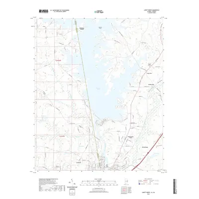
2020 Map of Lanett North
USGS Topo · Published 2020About this map
West Point Lake dominates the central landscape of this 2020 borderland survey, where the Alabama-Georgia state line bisects the water. This modern topography illustrates the complex interface between the expanding urban footprints of Lanett, Alabama, and West Point, Georgia. The map provides significant genealogical value through its documentation of numerous burial grounds, including the Fort Tyler Cem 2 and the Long Cane Baptist Church Cem to the east.
Find a feature on this map
113 named features on this map. Tap any name to fly to it.
Don’t see what you’re looking for? This feature index may not catch every label — zoom into the map to look around manually.
Map Details
Editions of this 2020 Lanett North Map
This is the sole edition of this map. No revisions or reprints were ever made.
Other maps of this area

1899 · Wedowee
USGS Topo · 1:125,000

1902 · Wedowee
USGS Topo · 1:125,000

1907 · Opelika
USGS Topo · 1:125,000

1909 · Opelika
USGS Topo · 1:125,000

1953 · Atlanta
USGS Topo · 1:250,000

1955 · Phenix City
USGS Topo · 1:250,000

1957 · Phenix City
USGS Topo · 1:250,000

1957 · Atlanta
USGS Topo · 1:250,000

1958 · Phenix City
USGS Topo · 1:250,000

1958 · Atlanta
USGS Topo · 1:250,000