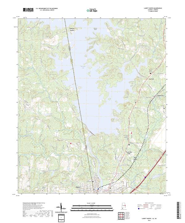
2024 Map of Lanett North
USGS Topo · Published 2024About this map
The Chattahoochee River corridor along the Alabama Georgia state line is dominated by the expansive West Point Lake, which separates the industrial center of Lanett from the smaller settlements in Georgia. The landscape is characterized by a dense concentration of family and community burial grounds, such as the Fort Tyler Cem and Lovelace Cem Number 2, marking the long-established residential patterns of Chambers and Troup counties.
Find a feature on this map
111 named features on this map. Tap any name to fly to it.
Don’t see what you’re looking for? This feature index may not catch every label — zoom into the map to look around manually.
Map Details
Editions of this 2024 Lanett North Map
This is the sole edition of this map. No revisions or reprints were ever made.
Other maps of this area

1899 · Wedowee
USGS Topo · 1:125,000

1902 · Wedowee
USGS Topo · 1:125,000

1907 · Opelika
USGS Topo · 1:125,000

1909 · Opelika
USGS Topo · 1:125,000

1953 · Atlanta
USGS Topo · 1:250,000

1955 · Phenix City
USGS Topo · 1:250,000

1957 · Phenix City
USGS Topo · 1:250,000

1957 · Atlanta
USGS Topo · 1:250,000

1958 · Phenix City
USGS Topo · 1:250,000

1958 · Atlanta
USGS Topo · 1:250,000