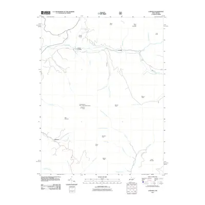
2011 Map of Laneville
USGS Topo · Published 2011About this map
Red Creek carves a central path through this high-altitude landscape, defining the character of small mountain settlements like Laneville and Canaan Crossing. In the early 21st century, this terrain remains largely defined by its prominent summits and plateau-like expanses. The map records several distinctive peaks and landmarks, including the high-elevation Flatrock Plains and Roaring Plains, as well as named elevations like Weiss Knob, Haystack Knob, and the curiously named Thunderstruck Rock near Mount Porte Crayon. For those interested in local family history, the Flanagan Memorial Cemetery sits near East Lanseville (CR45/4) Rd. The settlement of Harperton is positioned in the southwestern portion of the sheet near Horsecamp Run, where the topography shifts into a dense network of watercourses including Elklick Run and Roaring Creek.
Find a feature on this map
38 named features on this map. Tap any name to fly to it.
Don’t see what you’re looking for? This feature index may not catch every label — zoom into the map to look around manually.
Map Details
Editions of this 2011 Laneville Map
This is the sole edition of this map. No revisions or reprints were ever made.
Other maps of this area

1886 · St. George
USGS Topo · 1:125,000

1889 · Beverly
USGS Topo · 1:125,000

1891 · St. George
USGS Topo · 1:125,000

1892 · Beverly
USGS Topo · 1:125,000

1892 · Franklin
USGS Topo · 1:125,000

1895 · Piedmont
USGS Topo · 1:125,000

1896 · Franklin
USGS Topo · 1:125,000

1908 · Parsons
USGS Topo · 1:62,500

1916 · Davis
USGS Topo · 1:48,000

1918 · Davis
USGS Topo · 1:62,500