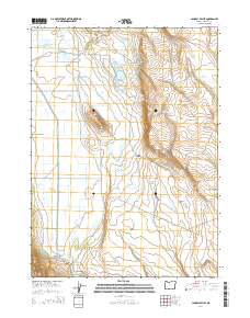
2014 Map of Langell Valley
USGS Topo · Published 2014About this map
The Lost River meanders through the high desert basin of Langell Valley, defining a landscape heavily shaped by water management and irrigation. This 2014 survey documents a complex network of man-made and natural water systems, including the Willow Valley Canal and the E Malone Lateral, which support the agricultural life of the valley. Notable landmarks like Gift Butte and the deep recesses of Woolen Canyon break the horizon, while numerous localized water sources such as Kilgore Spring and Hargadine Spring hint at the importance of every drop in this arid region.
Find a feature on this map
32 named features on this map. Tap any name to fly to it.
Don’t see what you’re looking for? This feature index may not catch every label — zoom into the map to look around manually.
Map Details
Editions of this 2014 Langell Valley Map
This is the sole edition of this map. No revisions or reprints were ever made.
Other maps of this area

1886 · Modoc Lava Bed
USGS Topo · 1:250,000

1889 · Klamath
USGS Topo · 1:250,000

1892 · Modoc Lava-Bed
USGS Topo · 1:250,000

1894 · Klamath
USGS Topo · 1:250,000

1951 · Clear Lake Reservoir
USGS Topo · 1:62,500

1951 · Tulelake
USGS Topo · 1:62,500

1954 · Alturas
USGS Topo · 1:250,000

1955 · Klamath Falls
USGS Topo · 1:250,000

1957 · Malin
USGS Topo · 1:62,500

1958 · Alturas
USGS Topo · 1:250,000