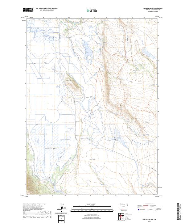
2023 Map of Langell Valley
USGS Topo · Published 2023About this map
Langell Valley is defined by a sophisticated network of irrigation and water management features vital to this Klamath County agricultural landscape. The presence of the East Malone Lateral and the Willow Valley Canal reveals how the Lost River and its tributaries, such as the East Branch Lost River, have been harnessed to support the valley floor. Low-lying areas like Malone Pool and Boggs Lake contrast with the sudden elevation of Gift Butte, providing a clear look at the geological transitions of the region.
Find a feature on this map
33 named features on this map. Tap any name to fly to it.
Don’t see what you’re looking for? This feature index may not catch every label — zoom into the map to look around manually.
Map Details
Editions of this 2023 Langell Valley Map
This is the sole edition of this map. No revisions or reprints were ever made.
Other maps of this area

1886 · Modoc Lava Bed
USGS Topo · 1:250,000

1889 · Klamath
USGS Topo · 1:250,000

1892 · Modoc Lava-Bed
USGS Topo · 1:250,000

1894 · Klamath
USGS Topo · 1:250,000

1951 · Clear Lake Reservoir
USGS Topo · 1:62,500

1951 · Tulelake
USGS Topo · 1:62,500

1954 · Alturas
USGS Topo · 1:250,000

1955 · Klamath Falls
USGS Topo · 1:250,000

1957 · Malin
USGS Topo · 1:62,500

1958 · Alturas
USGS Topo · 1:250,000