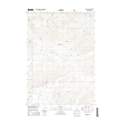
2013 Map of Langer Peak
USGS Topo · Published 2013About this map
Challis National Forest defines this high-elevation landscape in Custer County, dominated by the prominent Langer Peak and the high pass at Vanity Summit. The drainage network is complex, with numerous creeks such as Winnemucca Cr, Knapp Cr, and Valley Cr carving through the terrain. Alpine water bodies are a primary feature here, including the remote Elk Lake, Vanity Lakes, and the uniquely named F Eighty-Two Lake. Access to these remote reaches is provided by a network of forest roads including Beaver Creek Rd, Knapp Creek Rd, and the Pinyon Peak Loop Rd, which trace the valleys and ridges. The map illustrates a strictly natural and protected environment, showing no permanent settlements, but documenting the essential hydrology and topography of this Idaho wilderness.
Find a feature on this map
29 named features on this map. Tap any name to fly to it.
Don’t see what you’re looking for? This feature index may not catch every label — zoom into the map to look around manually.
Map Details
Editions of this 2013 Langer Peak Map
This is the sole edition of this map. No revisions or reprints were ever made.
Other maps of this area

1891 · Bear Valley
USGS Topo · 1:125,000

1893 · Bear Valley
USGS Topo · 1:125,000

1919 · Custer
USGS Topo · 1:125,000

1922 · Custer
USGS Topo · 1:125,000

1930 · Casto
USGS Topo · 1:125,000

1957 · Challis
USGS Topo · 1:250,000

1960 · Challis
USGS Topo · 1:250,000

1961 · Greyhound Ridge
USGS Topo · 1:62,500

1963 · Challis
USGS Topo · 1:250,000

1963 · Pinyon Peak
USGS Topo · 1:24,000