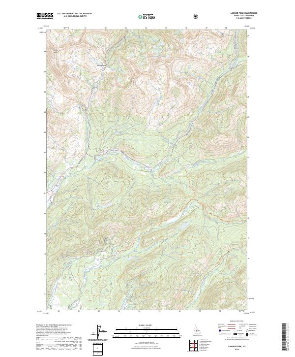
2024 Map of Langer Peak
USGS Topo · Published 2024About this map
Langer Peak stands as a prominent high point in this high-elevation landscape of Custer County, situated within the expansive Frank Church-River of No Return Wilderness. The map reveals a complex network of alpine hydrology and primitive transportation routes, where Vanity Creek and Crystal Creek drain the slopes near Vanity Summit. This 2024 edition documents the modern boundary of the Challis National Forest, providing a detailed look at the seasonal access routes that define mountain navigation, such as the Loon Creek Road (Winter Trail) Trail. Small mountain lakes like Dutch Lake, Elk Lake, and the uniquely named F Eighty-Two Lake dot the basins between ridges. The drainage patterns of Knapp Creek and Beaver Creek are paralleled by historic corridors like Seafoam Road, illustrating the continued reliance on these established paths through the central Idaho backcountry.
Find a feature on this map
41 named features on this map. Tap any name to fly to it.
Don’t see what you’re looking for? This feature index may not catch every label — zoom into the map to look around manually.
Map Details
Editions of this 2024 Langer Peak Map
This is the sole edition of this map. No revisions or reprints were ever made.
Other maps of this area

1891 · Bear Valley
USGS Topo · 1:125,000

1893 · Bear Valley
USGS Topo · 1:125,000

1919 · Custer
USGS Topo · 1:125,000

1922 · Custer
USGS Topo · 1:125,000

1930 · Casto
USGS Topo · 1:125,000

1957 · Challis
USGS Topo · 1:250,000

1960 · Challis
USGS Topo · 1:250,000

1961 · Greyhound Ridge
USGS Topo · 1:62,500

1963 · Challis
USGS Topo · 1:250,000

1963 · Pinyon Peak
USGS Topo · 1:24,000