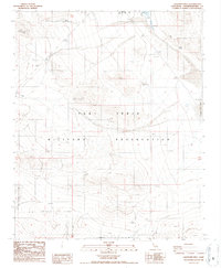
1986 Map of Langford Well
USGS Topo · Published 1986About this map
The Fort Irwin Military Reservation dominates this mid-1980s landscape, serving as a specialized military training environment in the High Desert. The map reveals the infrastructure of base operations, including a Radio Facility, Substation, Guard Station, and an Observation Tower. This operational footprint contrasts with the natural and historical features of the terrain, such as Painted Rocks and Garlic Spring. Near the eastern boundary, the Langford Well (Site) and the adjacent dry bed of Langford Well Lake indicate older water sources and landmarks that likely predated the heavy military use of the area. A network of 4wd tracks and a northern Levee system around Sewage Ponds illustrate how the environment has been modified for both logistics and waste management in a remote desert setting.
Find a feature on this map
17 named features on this map. Tap any name to fly to it.
Don’t see what you’re looking for? This feature index may not catch every label — zoom into the map to look around manually.
Map Details
Editions of this 1986 Langford Well Map
2 editions found
Other maps of this area

1933 · Avawatz Mountains
USGS Topo · 1:250,000

1947 · Trona
USGS Topo · 1:250,000

1948 · Trona
USGS Topo · 1:250,000

1948 · Alvord Mountain
USGS Topo · 1:62,500

1948 · Lane Mountain
USGS Topo · 1:62,500

1948 · Goldstone Lake
USGS Topo · 1:62,500

1948 · Tiefort Mountains
USGS Topo · 1:62,500

1951 · Goldstone Lake
USGS Topo · 1:62,500

1951 · Tiefort Mountains
USGS Topo · 1:62,500

1951 · Alvord Mountain
USGS Topo · 1:62,500