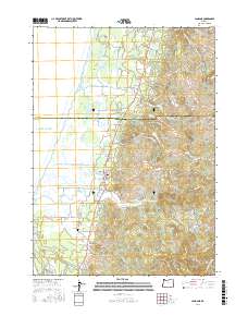
2017 Map of Langlois
USGS Topo · Published 2017About this map
The Pacific Ocean coastline of Curry County meets a complex hydrological landscape of coastal lakes and the meandering New River. This 2017 survey details the transition from the sandy lowlands near Floras Lake to the rising elevations of the Coast Range. The settlement of Langlois serves as a central hub along the highway, while the smaller community of Denmark is located further south near Willow Creek. Local history is anchored by landmarks such as the Denmark Cem and the Russell Bridge crossing Floras Creek. The terrain is defined by prominent coastal peaks including Morton Butte, Round Top, and White Mtn, which overlook a network of seasonal drainages like Bethel Creek and Butte Creek. The map documents how the New River runs parallel to the shore, creating a unique environment of freshwater lakes such as Croft Lake and Muddy Lake separated from the salt water by narrow dunes.
Find a feature on this map
59 named features on this map. Tap any name to fly to it.
Don’t see what you’re looking for? This feature index may not catch every label — zoom into the map to look around manually.
Map Details
Editions of this 2017 Langlois Map
This is the sole edition of this map. No revisions or reprints were ever made.
Other maps of this area

1896 · Coos Bay
USGS Topo · 1:125,000

1898 · Coos Bay
USGS Topo · 1:125,000

1899 · Port Orford
USGS Topo · 1:125,000

1900 · Coos Bay
USGS Topo · 1:125,000

1903 · Port Orford
USGS Topo · 1:125,000

1943 · Bandon
USGS Topo · 1:62,500

1944 · Bandon
USGS Topo · 1:62,500

1954 · Coos Bay
USGS Topo · 1:250,000

1954 · Cape Blanco
USGS Topo · 1:62,500

1954 · Langlois
USGS Topo · 1:62,500