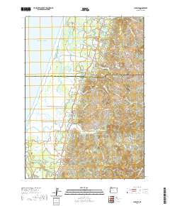
2020 Map of Langlois
USGS Topo · Published 2020About this map
Denmark and Langlois sit along the coastal corridor of the Pacific northwest in this contemporary topographic record. The landscape is defined by the complex hydrology of the New River, which runs parallel to the Pacific Ocean shoreline, separated by a narrow strip of land. This unique drainage pattern feeds into and out of several prominent water bodies such as Croft Lake, Muddy Lake, and New Lake. The transition from the coastal plains to the interior is marked by significant elevations including Morton Butte and White Mtn. To the south, the settlement of Denmark is documented alongside the Denmark Cem, providing essential points of reference for local family history and genealogy. The terrain is crisscrossed by a network of rural roads such as Floras Creek Rd and Langlois Mountain Rd, which provide access to the various forks and creeks like Butte Cr and Willow Cr.
Find a feature on this map
60 named features on this map. Tap any name to fly to it.
Don’t see what you’re looking for? This feature index may not catch every label — zoom into the map to look around manually.
Map Details
Editions of this 2020 Langlois Map
This is the sole edition of this map. No revisions or reprints were ever made.
Other maps of this area

1896 · Coos Bay
USGS Topo · 1:125,000

1898 · Coos Bay
USGS Topo · 1:125,000

1899 · Port Orford
USGS Topo · 1:125,000

1900 · Coos Bay
USGS Topo · 1:125,000

1903 · Port Orford
USGS Topo · 1:125,000

1943 · Bandon
USGS Topo · 1:62,500

1944 · Bandon
USGS Topo · 1:62,500

1954 · Coos Bay
USGS Topo · 1:250,000

1954 · Cape Blanco
USGS Topo · 1:62,500

1954 · Langlois
USGS Topo · 1:62,500