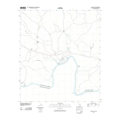
2010 Map of Langtry
USGS Topo · Published 2010About this map
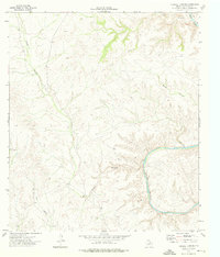
Langtry sits at the heart of this trans-border landscape, where the high desert meets the winding course of the Rio Grande. The town is situated near several prominent geological features, including the deep-cut Mile Canyon and Pump Canyon, which drain into the Amistad Reservoir. This 2010 survey illustrates a region defined by large-scale landholdings and isolated homesteads, such as the Obryane Ranch, J Fisher Ranch, and Billings Ranch, highlighting the enduring ranching culture of Val Verde County. Along the river, the international boundary between the United States and Mexico is clearly marked, following the natural meanders through Smokeys Vega and Rattlesnake Canyon. Local history is preserved at the Babb Cemetery, located just south of the settlement, while the network of roads including Pandale Rd and Hartgrove-Winters Rd provide the primary connections through the arid terrain of Osman Canyon and G 4 Canyon.
Find a feature on this map
23 named features on this map. Tap any name to fly to it.
Don’t see what you’re looking for? This feature index may not catch every label — zoom into the map to look around manually.
Map Details
Editions of this 2010 Langtry Map
This is the sole edition of this map. No revisions or reprints were ever made.
Other maps of this area

1943 · Langtry
USGS Topo · 1:62,500

1943 · Shumla
USGS Topo · 1:62,500

1944 · Mouth Of Pecos
USGS Topo · 1:62,500

1958 · Del Rio
USGS Topo · 1:250,000

1964 · Del Rio
USGS Topo · 1:250,000
1972 · Zuberbueler Bend NW
USGS Topo · 1:24,000

1973 · Langtry
USGS Topo · 1:24,000
1973 · Still Canyon
USGS Topo · 1:24,000
1973 · Shumla
USGS Topo · 1:24,000
1973 · Harkell Canyon
USGS Topo · 1:24,000