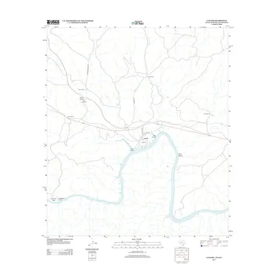
2013 Map of Langtry
USGS Topo · Published 2013About this map
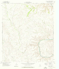
Langtry sits as a high desert crossroads overlooking the Rio Grande in this survey of the Texas-Mexico borderlands. The town is flanked by dramatic landscape features including Mile Canyon and Pump Canyon, illustrating the carved, limestone-dominated topography of the lower Trans-Pecos. This map documents a ranching landscape defined by family-held properties such as J Fisher Ranch, Obryane Ranch, and Ingram Ranch, which are connected by a sparse network of roads like Pandale Rd and Hartgrove-Winters Rd. Near the settlement, Babb Cem provides a point of genealogical interest, while the natural geography is highlighted by features like Seep Springs and Rattlesnake Canyon. This 2013 edition details the modern interface between the remote ranching community and the international boundary, showing the rugged corridor through which the river flows past Smokeys Vega.
Find a feature on this map
20 named features on this map. Tap any name to fly to it.
Don’t see what you’re looking for? This feature index may not catch every label — zoom into the map to look around manually.
Map Details
Editions of this 2013 Langtry Map
This is the sole edition of this map. No revisions or reprints were ever made.
Other maps of this area

1943 · Langtry
USGS Topo · 1:62,500

1943 · Shumla
USGS Topo · 1:62,500

1944 · Mouth Of Pecos
USGS Topo · 1:62,500

1958 · Del Rio
USGS Topo · 1:250,000

1964 · Del Rio
USGS Topo · 1:250,000
1972 · Zuberbueler Bend NW
USGS Topo · 1:24,000

1973 · Langtry
USGS Topo · 1:24,000
1973 · Still Canyon
USGS Topo · 1:24,000
1973 · Shumla
USGS Topo · 1:24,000
1973 · Harkell Canyon
USGS Topo · 1:24,000