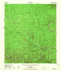
1943 Map of Langtry
USGS Topo · Published 1967About this map
The Rio Grande and Pecos River carve deep canyons through this portion of Val Verde County, where the international boundary separates Texas from Coahuila, Mexico. The settlement of Langtry sits near the river's edge, served by the Texas and New Orleans railroad line that traverses the landscape. This railroad is the primary artery through the region, connecting isolated outposts like Pumpville, Hijito, and Osman across the drainage basins of Langtry Canyon and Osman Canyon.
Find a feature on this map
45 named features on this map. Tap any name to fly to it.
Don’t see what you’re looking for? This feature index may not catch every label — zoom into the map to look around manually.
Map Details
Editions of this 1943 Langtry Map
2 editions found
Other maps of this area

1943 · Malvado
USGS Topo · 1:62,500

1943 · Langtry
USGS Topo · 1:62,500

1943 · Shumla
USGS Topo · 1:62,500

1944 · Mouth Of Pecos
USGS Topo · 1:62,500

1944 · Malvado
USGS Topo · 1:62,500

1954 · Sonora
USGS Topo · 1:250,000

1958 · Sonora
USGS Topo · 1:250,000

1958 · Del Rio
USGS Topo · 1:250,000

1964 · Del Rio
USGS Topo · 1:250,000

1970 · Everett Canyon
USGS Topo · 1:24,000