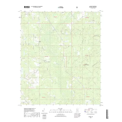
2018 Map of Lanham
USGS Topo · Published 2018About this map
De Soto National Forest blankets the southeastern portion of this Jones County landscape, where the mixed pine and hardwood terrain is defined by a dense network of watercourses including Bogue Homo and Tallahoma Cr. Small rural settlements at Lanham and Crotts serve as local anchors, connected by historic thoroughfares like Old Hwy 15 Rd and Ellisville Junction Rd. The land is deeply intersected by numerous small branches and creeks, such as Gator Br, Tiger Br, and Wildcat Cr, which have historically dictated the placement of homesteads and cemeteries.
Find a feature on this map
90 named features on this map. Tap any name to fly to it.
Don’t see what you’re looking for? This feature index may not catch every label — zoom into the map to look around manually.
Map Details
Editions of this 2018 Lanham Map
This is the sole edition of this map. No revisions or reprints were ever made.
Other maps of this area

1953 · Hattiesburg
USGS Topo · 1:250,000

1958 · Hattiesburg
USGS Topo · 1:250,000

1963 · Barrontown
USGS Topo · 1:24,000

1964 · Rhodes
USGS Topo · 1:24,000

1964 · Laurel East
USGS Topo · 1:24,000

1964 · Laurel West
USGS Topo · 1:24,000

1964 · Ovett
USGS Topo · 1:24,000

1964 · Ellisville
USGS Topo · 1:24,000

1964 · Myrick
USGS Topo · 1:24,000

1964 · Strengthford
USGS Topo · 1:24,000