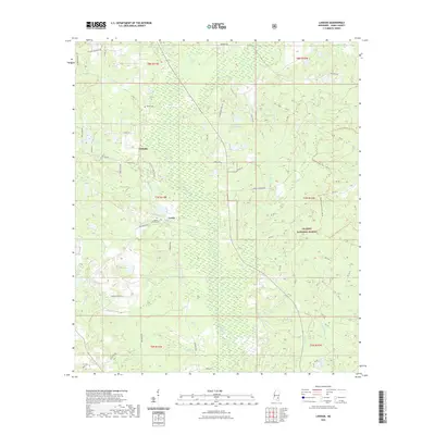
2021 Map of Lanham
USGS Topo · Published 2021About this map
De Soto National Forest covers much of the eastern landscape in this part of Jones County, where the terrain is defined by a dense network of tributaries feeding into the Bogue Homo. The small communities of Lanham and Crotts serve as local anchors, connected by a web of rural routes like Ellisville Junction Rd and Tuckers Crossing Rd. This 2021 survey reveals a landscape where family and community history is preserved in sites like Tucker Cem and Mount Moriah Cem.
Find a feature on this map
63 named features on this map. Tap any name to fly to it.
Don’t see what you’re looking for? This feature index may not catch every label — zoom into the map to look around manually.
Map Details
Editions of this 2021 Lanham Map
This is the sole edition of this map. No revisions or reprints were ever made.
Other maps of this area

1953 · Hattiesburg
USGS Topo · 1:250,000

1958 · Hattiesburg
USGS Topo · 1:250,000

1963 · Barrontown
USGS Topo · 1:24,000

1964 · Rhodes
USGS Topo · 1:24,000

1964 · Laurel East
USGS Topo · 1:24,000

1964 · Laurel West
USGS Topo · 1:24,000

1964 · Ovett
USGS Topo · 1:24,000

1964 · Ellisville
USGS Topo · 1:24,000

1964 · Myrick
USGS Topo · 1:24,000

1964 · Strengthford
USGS Topo · 1:24,000