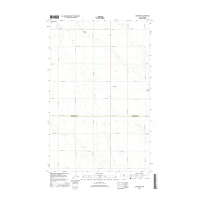
2014 Map of Lansford SE
USGS Topo · Published 2014About this map
The prairies of the Souris River Basin meet at the Bottineau Co and Renville Co boundary in this detailed study of the North Dakota landscape. The small settlement of Lansford sits in the northwest corner, while the rail siding or locality of Forfar occupies a central position along the north-south highway corridor. The terrain is defined by its drainage patterns, specifically the winding paths of Spring Coulee and Little Deep Cr, which carve subtle depressions through the agricultural grid. This 2014 survey documents a classic High Plains arrangement of section-line roads, such as 75th St NW and 30th Ave NW, which organize the rural space and provide access to the isolated farmsteads and fields that characterize this region of the northern borderlands.
Find a feature on this map
22 named features on this map. Tap any name to fly to it.
Don’t see what you’re looking for? This feature index may not catch every label — zoom into the map to look around manually.
Map Details
Editions of this 2014 Lansford SE Map
This is the sole edition of this map. No revisions or reprints were ever made.
Other maps of this area

1948 · Lansford
USGS Topo · 1:62,500

1948 · Burlington
USGS Topo · 1:62,500

1948 · Lansford SW
USGS Topo · 1:24,000

1949 · Burlington NW
USGS Topo · 1:24,000

1949 · Glenburn
USGS Topo · 1:24,000

1949 · Lansford NW
USGS Topo · 1:24,000

1949 · Lansford SW
USGS Topo · 1:24,000

1949 · Deering NW
USGS Topo · 1:24,000

1949 · Lansford SE
USGS Topo · 1:24,000

1949 · Lansford NE
USGS Topo · 1:24,000