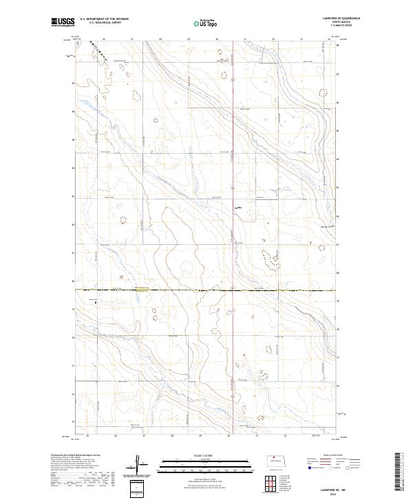
2024 Map of Lansford SE
USGS Topo · Published 2024About this map
The boundary between Bottineau Co and Renville Co runs horizontally through this landscape, dividing a region defined by agricultural plots and conservation lands. In the northern section, the Bottineau County Waterfowl Production Area occupies a significant portion of the terrain, preserving habitat for local bird populations. The small settlement of Forfar sits centrally along the main north-south artery, which is flanked by a grid of rural roads like Country Rd 26A and 80th St NW. To the south, Little Deep Creek meanders across the plain, while Spring Coulee cuts through the eastern edge. For genealogists and local historians, the presence of Shook Cem in the southwestern quadrant provides a specific point of interest for tracing the early residency and family lineages of these plains.
Find a feature on this map
21 named features on this map. Tap any name to fly to it.
Don’t see what you’re looking for? This feature index may not catch every label — zoom into the map to look around manually.
Map Details
Editions of this 2024 Lansford SE Map
This is the sole edition of this map. No revisions or reprints were ever made.
Other maps of this area

1948 · Lansford
USGS Topo · 1:62,500

1948 · Burlington
USGS Topo · 1:62,500

1948 · Lansford SW
USGS Topo · 1:24,000

1949 · Burlington NW
USGS Topo · 1:24,000

1949 · Glenburn
USGS Topo · 1:24,000

1949 · Lansford NW
USGS Topo · 1:24,000

1949 · Lansford SW
USGS Topo · 1:24,000

1949 · Deering NW
USGS Topo · 1:24,000

1949 · Lansford SE
USGS Topo · 1:24,000

1949 · Lansford NE
USGS Topo · 1:24,000