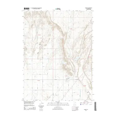
2014 Map of Lapoint
USGS Topo · Published 2014About this map
Tridell and Lapoint anchor this landscape in the Uinta Basin, where a complex network of man-made waterways supports high-desert agriculture. The prevalence of engineered irrigation, including the Whiterocks and Ouray Valley Canal, Deep Cr Canal, and Ouray Park Canal, reveals the critical reliance on diverted water from the north to sustain these rural communities. The map detail reflects a transition from the structured residential grid of Tridell to the more dispersed homesteads and agricultural plots near Lapoint.
Find a feature on this map
34 named features on this map. Tap any name to fly to it.
Don’t see what you’re looking for? This feature index may not catch every label — zoom into the map to look around manually.
Map Details
Editions of this 2014 Lapoint Map
This is the sole edition of this map. No revisions or reprints were ever made.
Other maps of this area

1885 · Ashley
USGS Topo · 1:250,000

1906 · Marsh Peak
USGS Topo · 1:125,000

1908 · Marsh Peak
USGS Topo · 1:125,000

1917 · Vernal
USGS Topo · 1:125,000

1954 · Vernal
USGS Topo · 1:250,000

1958 · Vernal
USGS Topo · 1:250,000

1960 · Vernal
USGS Topo · 1:250,000
1964 · Fort Duchesne
USGS Topo · 1:24,000

1964 · Lapoint
USGS Topo · 1:24,000
1964 · Whiterocks
USGS Topo · 1:24,000