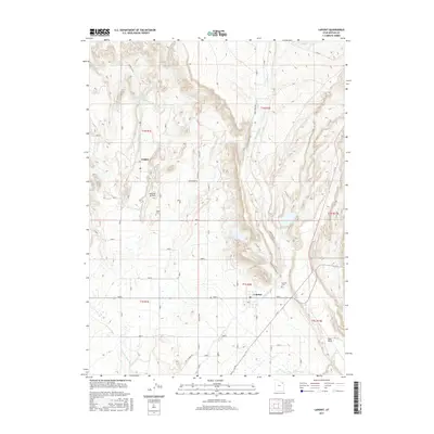
2017 Map of Lapoint
USGS Topo · Published 2017About this map
Agricultural irrigation networks define the landscape around Tridell and Lapoint in this 2017 study of northeastern Utah. The intricate system of water management is visible through the Whiterocks and Ouray Valley Canal, Deep Cr Canal, and Ouray Park Canal, which redirect flows to support the high desert basin. These man-made waterways contrast with natural features like Deep Cr and Little Water, illustrating the vital role of engineering in the region's development.
Find a feature on this map
26 named features on this map. Tap any name to fly to it.
Don’t see what you’re looking for? This feature index may not catch every label — zoom into the map to look around manually.
Map Details
Editions of this 2017 Lapoint Map
This is the sole edition of this map. No revisions or reprints were ever made.
Other maps of this area

1885 · Ashley
USGS Topo · 1:250,000

1906 · Marsh Peak
USGS Topo · 1:125,000

1908 · Marsh Peak
USGS Topo · 1:125,000

1917 · Vernal
USGS Topo · 1:125,000

1954 · Vernal
USGS Topo · 1:250,000

1958 · Vernal
USGS Topo · 1:250,000

1960 · Vernal
USGS Topo · 1:250,000
1964 · Fort Duchesne
USGS Topo · 1:24,000

1964 · Lapoint
USGS Topo · 1:24,000
1964 · Whiterocks
USGS Topo · 1:24,000