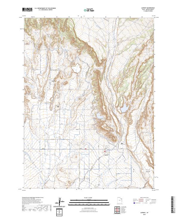
2023 Map of Lapoint
USGS Topo · Published 2023About this map
Tridell and Lapoint serve as the primary hubs in this corner of Uintah County, where an intricate network of waterways supports the local landscape. The map reveals the critical importance of irrigation and water management through features like the Whiterocks and Ouray Valley Canal, Deep Creek Canal, and Ouray Park Canal. These engineered channels cut through the terrain alongside natural features such as Little Water and Deep Creek, illustrating how the community has historically harnessed the East Channel Uinta River for agriculture. Genealogists and local historians can pinpoint the Tridell Cem and Lapoint Cem, while landmarks like Paradise Air Park and the uniquely named Turkey Track road highlight the mix of aviation and rural navigation. The geography is further defined by the southern Sand Wash, marking a transition in the local hydrology near the Lapoint Hwy.
Find a feature on this map
18 named features on this map. Tap any name to fly to it.
Don’t see what you’re looking for? This feature index may not catch every label — zoom into the map to look around manually.
Map Details
Editions of this 2023 Lapoint Map
This is the sole edition of this map. No revisions or reprints were ever made.
Other maps of this area

1885 · Ashley
USGS Topo · 1:250,000

1906 · Marsh Peak
USGS Topo · 1:125,000

1908 · Marsh Peak
USGS Topo · 1:125,000

1917 · Vernal
USGS Topo · 1:125,000

1954 · Vernal
USGS Topo · 1:250,000

1958 · Vernal
USGS Topo · 1:250,000

1960 · Vernal
USGS Topo · 1:250,000
1964 · Fort Duchesne
USGS Topo · 1:24,000

1964 · Lapoint
USGS Topo · 1:24,000
1964 · Whiterocks
USGS Topo · 1:24,000