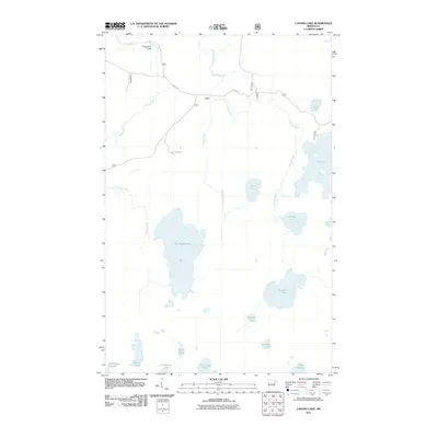
2011 Map of Lapond Lake
USGS Topo · Published 2011About this map
The Moose River Portage anchors the northern reaches of this map, tracing a traditional route through a landscape defined by an intricate network of waterways and glacial basins. This 2011 survey illustrates a region dominated by major water bodies such as Big Moose Lake, Lapond Lake, and Big Rice Lake, which are interconnected by the Moose River and Portage River. These drainages represent essential corridors for travel and local ecology in Saint Louis County.
Find a feature on this map
18 named features on this map. Tap any name to fly to it.
Don’t see what you’re looking for? This feature index may not catch every label — zoom into the map to look around manually.
Map Details
Editions of this 2011 Lapond Lake Map
This is the sole edition of this map. No revisions or reprints were ever made.
Other maps of this area

1933 · Ely
USGS Topo · 1:62,500

1939 · Ely
USGS Topo · 1:62,500

1954 · Two Harbors
USGS Topo · 1:250,000

1954 · Hibbing
USGS Topo · 1:250,000

1954 · International Falls
USGS Topo · 1:250,000

1956 · Chad Lake
USGS Topo · 1:24,000

1956 · Crab Lake
USGS Topo · 1:24,000

1957 · Two Harbors
USGS Topo · 1:250,000

1957 · Hibbing
USGS Topo · 1:250,000

1957 · International Falls
USGS Topo · 1:250,000