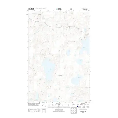
2013 Map of Lapond Lake
USGS Topo · Published 2013About this map
The Superior National Forest encompasses this vast, water-rich landscape in Saint Louis County, where a complex network of glacial lakes and rivers defines the local geography. The central Big Moose Lake and eastern Lapond Lake are connected by the winding course of the Portage River and Duck Creek, illustrating the classic boreal water systems of northern Minnesota. This map captures the area in the early 21st century, showing how modern forestry roads like Co Hwy 116 and Forest Rte 206 overlay ancient travel corridors. Historical transit patterns are visible in features like the Moose River Portage, a traditional land bridge between the Moose River and the neighboring watersheds of Johns Creek. The southern reaches of the quadrangle are densely clustered with smaller water bodies, including Wail Lake, Neewin Lake, and Cummings Lake, which remain largely roadless and primitive.
Find a feature on this map
23 named features on this map. Tap any name to fly to it.
Don’t see what you’re looking for? This feature index may not catch every label — zoom into the map to look around manually.
Map Details
Editions of this 2013 Lapond Lake Map
This is the sole edition of this map. No revisions or reprints were ever made.
Other maps of this area

1933 · Ely
USGS Topo · 1:62,500

1939 · Ely
USGS Topo · 1:62,500

1954 · Two Harbors
USGS Topo · 1:250,000

1954 · Hibbing
USGS Topo · 1:250,000

1954 · International Falls
USGS Topo · 1:250,000

1956 · Chad Lake
USGS Topo · 1:24,000

1956 · Crab Lake
USGS Topo · 1:24,000

1957 · Two Harbors
USGS Topo · 1:250,000

1957 · Hibbing
USGS Topo · 1:250,000

1957 · International Falls
USGS Topo · 1:250,000