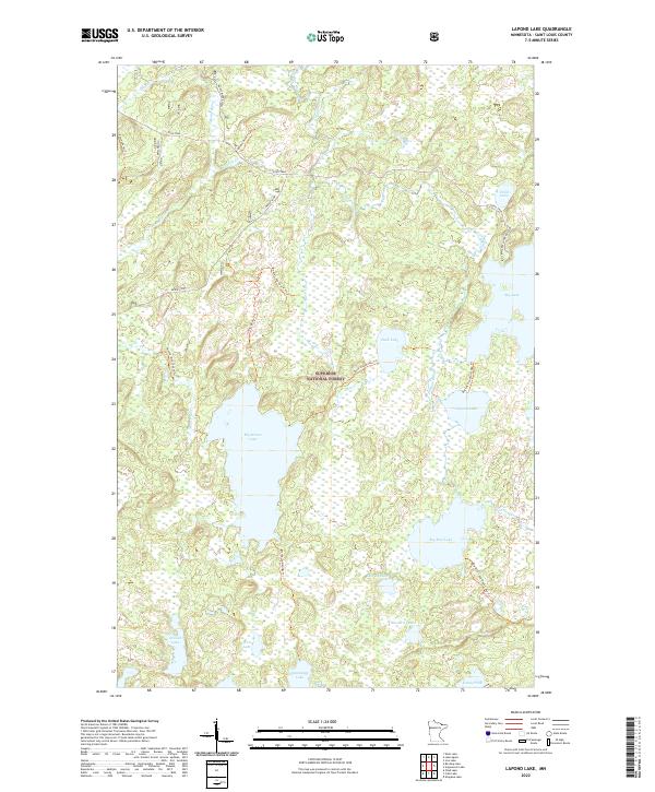
2022 Map of Lapond Lake
USGS Topo · Published 2022About this map
Superior National Forest encompasses this water-rich expanse of Saint Louis County, where a complex network of glacial lakes and river systems dictates the movement of travelers. The primary corridor through the north is the Echo Trail, which provides access to primitive routes like the Moose River Trl and the Kessanen Pit Trl. Evidence of local industry appears at the Kessanen Pit near the headwaters of Johns Cr. Central to the geography are large water bodies including Big Moose Lake and Big Rice Lake, connected by smaller waterways such as Duck Cr and the Portage River. A dense system of portages and hiking paths, including the Moose-Cummings Trl and the Big Lake-Lapond Lake Trl, links the isolated waters of Medley Lake, Blizzard Lake, and Wail Lake, reflecting a landscape managed for wilderness recreation and conservation.
Find a feature on this map
36 named features on this map. Tap any name to fly to it.
Don’t see what you’re looking for? This feature index may not catch every label — zoom into the map to look around manually.
Map Details
Editions of this 2022 Lapond Lake Map
This is the sole edition of this map. No revisions or reprints were ever made.
Other maps of this area

1933 · Ely
USGS Topo · 1:62,500

1939 · Ely
USGS Topo · 1:62,500

1954 · Two Harbors
USGS Topo · 1:250,000

1954 · Hibbing
USGS Topo · 1:250,000

1954 · International Falls
USGS Topo · 1:250,000

1956 · Chad Lake
USGS Topo · 1:24,000

1956 · Crab Lake
USGS Topo · 1:24,000

1957 · Two Harbors
USGS Topo · 1:250,000

1957 · Hibbing
USGS Topo · 1:250,000

1957 · International Falls
USGS Topo · 1:250,000